Overview
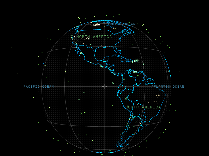
Vector Globe renders satellites, aircraft, earthquakes, and wildfires on a WGS84-accurate Earth at vector-globe.vercel.app. Four data layers are implemented without API keys. Satellites, earthquakes, and fires are available in the public build; the aircraft feed currently works locally only because OpenSky blocks connections from the production host. The black-and-phosphor "Radyn" interface is still growing, with a performance-hardening pass that found and fixed two memory leaks in the rendering stack.
Why Rebuild in 3D
The starting point was Bilawal Sidhu's WorldView, a 2D Canvas globe built with D3. WorldView draws a sphere, but everything on it is still a flat projection. A satellite at 400km and one at 20,000km end up as two dots on the same surface, altitude has no coordinate.
Vector Globe is a ground-up rebuild in Three.js and React Three Fiber for exactly one reason: so data can plot at true altitude. The Earth is a unit sphere, and every point gets radius = 1 + alt / EARTH_RADIUS, computed per object, per frame. ISS sits at 1.064x Earth's radius. GPS satellites sit at 4.17x. GEO satellites ring the globe at roughly 6.6x. That's not a visual effect, it's the same math NASA uses to plot orbits, just running in a browser tab. The third dimension is the entire reason this is its own project instead of a WorldView feature branch.
Four Layers, Zero Keys
Every layer pulls from a free public feed. There isn't a single API key anywhere in the app, in dev or in production.
- Satellites: ~295 TLEs pulled from CelesTrak's group feeds (visual, gps-ops, galileo, glo-ops, geo), each one propagated with real SGP4 math via
satellite.jsevery frame, not a synthetic placeholder orbit. LEO, MEO, and GEO are all visible at true relative scale in the same view. Select one and it draws a full-period orbit trace, an ellipse for LEO, a tight ring for GEO. - Aircraft: OpenSky Network ADS-B state vectors, roughly 6,000 aircraft at a time, rendered as heading-oriented triangles with a live flight-path trace on selection.
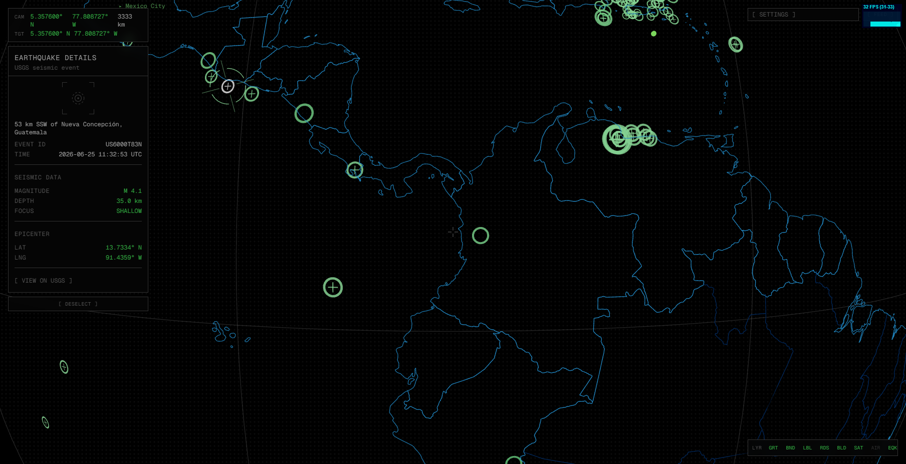
- Earthquakes: USGS's 30-day M2.5+ feed, 500 events, and the first layer that had to render below the surface.
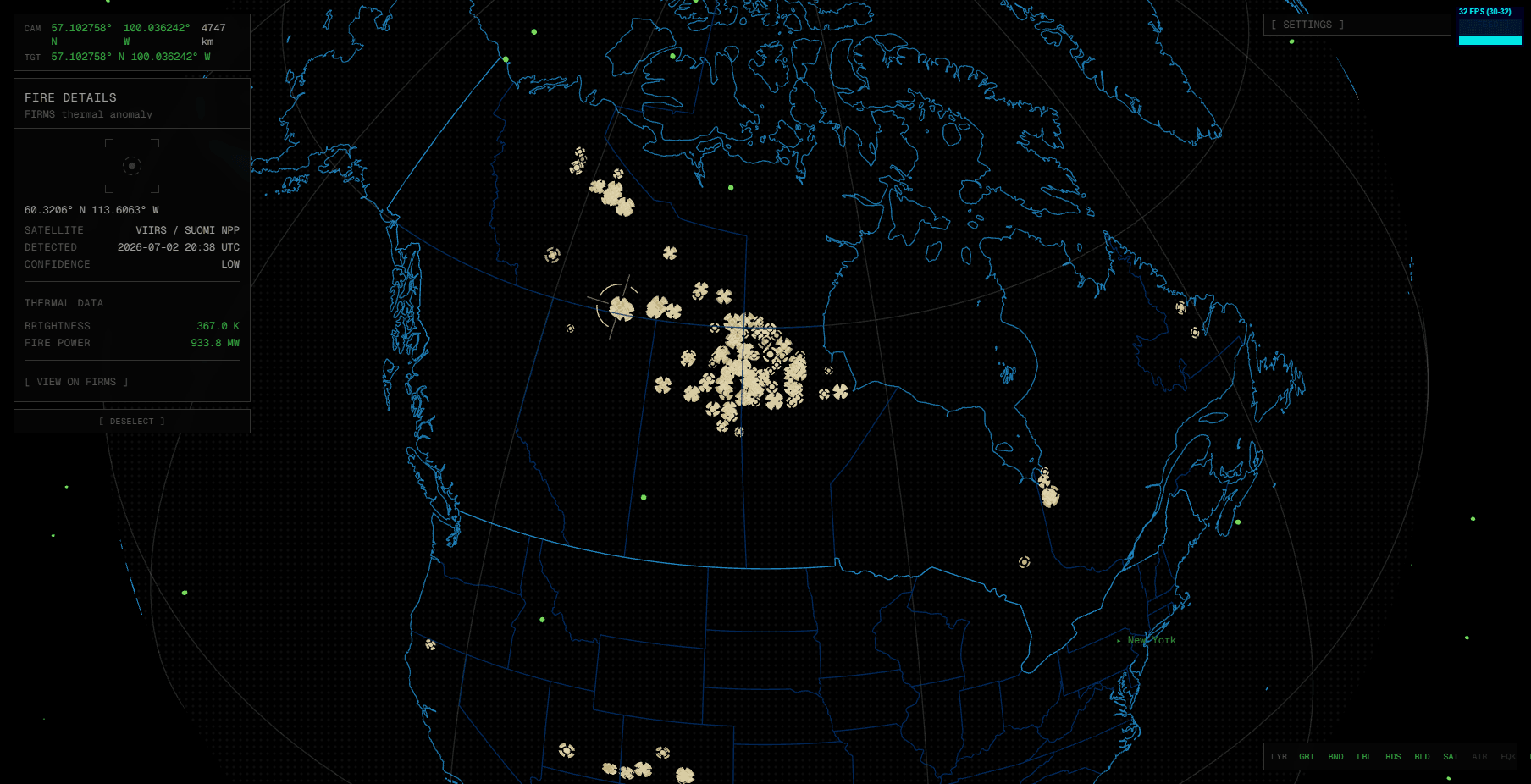
- Fires: NASA FIRMS VIIRS Suomi-NPP 24h feed, the top 5,000 of anywhere from 70,000 to 124,000 daily detections, ranked by fire radiative power.
The problem with rendering below the surface
The Earth mesh is opaque. A marker placed at negative altitude, an earthquake hypocenter under the crust, is geometrically occluded from every camera angle by default. The fix is depthTest: false on the marker, combined with a per-frame near-hemisphere cull (dot(normal, camDir) > 1/d) so markers on the far side of the planet don't bleed through. That same cull gates the click targets, so you can't select a quake through the planet, and it gates the shared selection reticle too.
That last part mattered because it wasn't obvious at first. The reticle component was written for satellites and aircraft, both of which sit above the surface, and it depth-tested against the opaque Earth by default. An adversarial code-review pass on that step caught it: the reticle could never actually render for a sub-surface target. What looked like a working selection indicator in an early screenshot was the ring itself changing color, not the reticle. Fixed by adding a depthTest prop to the reticle, off by default for earthquakes, folded into the same hemisphere cull as the ring.
Magnitude scales ring size, depth darkens a single hue, and shallow-focus events get a crosshair. No red or orange anywhere, the palette stays one accent color.
Going keyless on purpose
The fire layer's plan called for an API key in a VITE_ environment variable. Partway through, the actual problem became clear: VITE_-prefixed variables get inlined into the client bundle at build time. Anyone can open devtools and read it. It isn't a secret, it's a fake secret with all the friction of a real one, signup, rotation, an env var to manage in Vercel.
The fix was to drop the area API and pull FIRMS' public global CSV instead, through a same-origin proxy. Same VIIRS data, same product, zero keys, zero env vars in production.
How It Gets Built
docs/ACTION_PLAN.md is the source of truth for the project: a step-by-step build plan with a dense log entry appended after every step, and a separate decisions log for anything non-obvious. Two habits carry the most weight:
- Every step gets browser-verified in real Chrome before it's committed. Not a unit test standing in for the real thing, the actual rendered globe, clicked through, screenshotted.
- Every step gets an adversarial code-review pass, and it's caught real bugs, not just style nits. The earthquake reticle bug above is one example.
The decisions log also has a moment worth mentioning because it's a canceled idea, not a shipped one. After four data layers (satellites, aircraft, earthquakes, fires), the plan called for extracting a generic <EntityLayer> rendering harness so the fifth layer onward wouldn't need a full clone-and-modify pass. The retrospective canceled it: the four layers diverge exactly where a harness would need to be generic, per-frame SGP4 propagation for satellites, a static snapshot for aircraft, sub-surface depth culling for earthquakes, surface-level rendering for fires. A harness would need a knob per axis and would fight the earthquake layer hardest of all. Cloning per layer cost about one session each, including the browser verify. That was cheaper than the abstraction.
The Two Leaks
Four layers in, the plan called for a full performance re-baseline before adding a fifth. Not vibes, numbers: heap growth per layer toggle, main-thread self-time per frame, allocation rate, all captured on a fixed rig (Chrome 149, RTX 3080, DPR 1) and written down as the numbers to beat. The audit graded two critical problems, and both came from the same mistake, trusting a framework to clean up after itself.
The first showed up as memory. Toggling a data layer off and back on grew the heap 33.9% and never gave it back. Two separate root causes, both buried in framework internals.
React Three Fiber does not dispose geometry or materials you hand it through args or props. Three.js r170 keeps a VAO and every vertex attribute in its WebGLBindingStates table, keyed by geometry.id, and only releases them when you call geometry.dispose() yourself. Every toggle built fresh geometry, R3F mounted it and later unmounted it, and the GPU-side bindings stayed pinned for the life of the tab. The fix splits by kind: static geometry and materials are hoisted to module-scope singletons, allocated once for the whole app, and the genuinely dynamic geometry (the border tiers that rebuild when new data loads) gets an explicit dispose() on replace and on unmount.
The second was the labels. Every city name was a drei <Html>, and each <Html> is a full React root carrying roughly 138 event listeners. Unmounting one from inside the R3F render commit orphans the root instead of tearing it down, and the label set churns constantly as you pan, so this one didn't wait for a toggle, it leaked the entire time the globe was moving. The fix was to delete the per-label roots and render a single overlay <div> outside the Canvas, positioned every frame by imperative transforms fed from a small pub/sub store. One DOM node for the whole label layer instead of one React root per city.
Same protocol afterward: 33.9% growth per toggle dropped to 1.76% on the steady-state run, with zero Three.js constructor growth across the cycle, inside the ±2% bar the baseline set. (The first run after a fresh load still shows about +9%, which turned out to be React 19 holding one generation of unmounted fibers, bounded and one-time, so the honest number is the second run.)
Both root causes are now written into the project's non-negotiable rules, the same file that governs the aesthetic: never hand per-mount geometry to R3F's args without a singleton or an explicit dispose, and never use a per-entity drei <Html>. The bug became a guardrail.
The re-baseline caught more than the leak. Three other measured wins came out of the same pass:
| Fix | Before | After |
|---|---|---|
| SGP4 propagation (main-thread self-time) | 0.606 ms/frame | 0.113 ms/frame |
| SGP4 allocation rate | 7.10 MB/s | 1.65 MB/s |
| Store commits while interacting | ~250/s | ~45/s |
| Duplicate tile fetches (street zoom) | 2× every tile | 0 |
Propagating ~295 satellites with real SGP4 every frame is the single most expensive thing the app does. Splitting them into four cohorts, so only the selected satellite recomputes every frame and the rest round-robin, and rewriting the hot coordinate math to fill a reused vector instead of allocating a fresh one, cut its self-time 81%. The store commits came down by throttling camera-position writes to every 90ms while keeping altitude per-frame, so zoom tiers still respond instantly but Zustand isn't re-rendering the tree 250 times a second. The duplicate tile fetches were two tile managers independently requesting the same map tiles; a shared in-flight-promise cache with a decoded LRU collapsed them to one request each. And the whole thing is fenced now: a gzip bundle-size budget runs inside npm run build and fails the build if a change pushes the bundle past its ceiling, so a regression never reaches Vercel.
Production
The app deployed to Vercel on 2026-07-03, push-to-deploy from main:
| Metric | Value |
|---|---|
| Gzipped bundle | 324.67 kB |
| Lighthouse Accessibility | 100 |
| Lighthouse Best Practices | 100 |
| Lighthouse SEO | 90 |
| Deploy time | ~25s from git push |
Current State
Live, and the four-layer definition of done is met. It's still growing, not finished. One known limitation: OpenSky blocks connection attempts from Vercel's edge IPs, so the aircraft layer works locally but errors out gracefully in production right now (it defaults off, no crash). Fixing that, either an authenticated OpenSky connection or an alternate ADS-B source, is scoped as the next infrastructure step.
Four implemented data layers, three available in the public build, with altitude as the entire point.